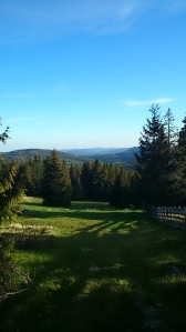
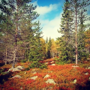
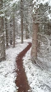
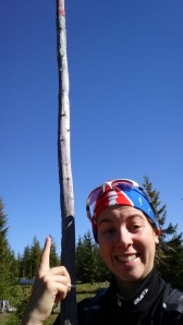
In two and a half years, I have drawn 6 maps in Norway. Two are sprint maps, the other four forest. I have been lucky to visit some of the most beautiful hidden gems Hadeland has to offer. I’ve stood in Geilo, surrounded by 2m+ high boulders. I’ve met a wolf, seen and heard Capercaillie, stepped on a python-like Adder and been attacked by sheep. I’ve mapped in summer when the mosquitos eat every available millimeter of bare skin, and in Autumn when the colours change subtly every day. I love mapping. I find a wonderful sense of freedom; being outside in all weathers, exploring places that no-one has been before, and getting into the head of the Foot Orienteer when deciding what to map.
My first four maps were drawn with the good old fashioned method: pen and paper. For those unfamiliar with mapping, the ‘paper’ part is a laminated base map with tracing paper over the top. The base map can be Lidar data, a flyfoto, an old FootO map, or any other kind of map. I used a separate GPS device in these early maps that gave my location reasonably well. The screen was small, and there was a degree of inaccuracy between the GPS location and my location, and once again as I drew the feature on the paper. In vague terrain, this method was surprisingly tough.
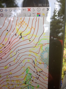
Mapping by tablet. Vegetation drawn as scribble onto a background image. Point features drawn directly into OOM.
I was lucky in the autumn of 2012 to meet the O-Ringen 2013 mappers in Boden. I was allowed to take a trip with one of them for a couple of hours, an experience that was really worthwhile. Being able to discuss features in the terrain was useful, and I started to see perhaps I spent too much time considering small details rather than the broader picture. The team used small handheld GPS devices, with a mapping programme loaded on. Drawing the map directly to the device seemed to make things more efficient. Combined with a GPS it was easy to draw the feature one was looking at, in precisely the correct place.
We waited a year before doing anything, plenty of time to consider the pro’s and con’s of using electronic equipment for mapping. Hans Jørgen did a great deal of research into the subject, and eventually settled on a Sony Xperia Z2 tablet. He purchased it with an external bluetooth GPS and extra battery pack. Loaded onto the device is Open Orienteering Mapper (tablet version). We even purchased an additional ‘hand holder’ device that allows me to slip my hand inside a strap underneath, thus preventing the need to hold onto the sides. It makes for a more stable surface while drawing. At first the tablet gave me bad forearm and shoulder pain, but after a week the muscles have adapted and no longer cramp up. The inbuilt camera works well for quickly needing to take a picture of a wolf, snake, capercallie or other forest creatures!
The tablet itself is fully waterproof, and with constant use for mapping, has a battery life of 5 hours. The external pack gives up to an extra two hours. It is worth familiarising oneself with OOM on the desktop first, to understand the different symbols and functions. While slightly different to OCAD, in my opinion OOM works just as well for drawing. The OOM programme uses a ‘scribble’ background image that one can draw on in the same way as pen and paper. I tend to drawn vegetation here, and point features on the actual map. In this way my workload at the desktop later is considerably reduced, as I only need to draw on the vegetation.
My two maps this ‘summer’ (if spring and autumn count as summer in Norway) have been drawn with the tablet. On the whole it has worked well. In moderate rain, work takes a little longer (a dry item of clothing is necessary as the screen becomes confused when water drops are present), all too often I have gone to draw a boulder and found a hundred suddenly appearing. I had far greater problems drawing on paper in the rain, so the tablet at least allows me to get out even if for a few hours in light to moderate rainy conditions. In heavy rain however, one will have great difficulty, but once again, that’s no change to the challenges faced by my previous pen/paper method.
On Wednesday I had an issue with the tablet. It meant I was unable to draw on one half of the screen, so I had to return home. On Thursday I was back to the old method: pen and paper, but I noticed something strange. The tablet meant I could drawn more detail on the map in a smaller space. I was already aware of this, and often draw more detail and delete it later as space allows (this helps me to remember more precisely the density of rock and vegetation in some areas). But pen and paper didn’t allow this. As a result I covered the terrain more quickly and with the level of detail that will go on the final version. Vegetation however was harder to draw, as it took longer to erase my work and redraw it as I viewed it from another angle.
While pen and paper is the faster and more generalised method in the forest, the advantages of the tablet quickly win over the old skool method. The tablet allows for greater accuracy in dense vegetation or extremely rocky/technical contour detailed areas. I can draw precisely where a rock is based on my GPS dot. While I wouldn’t go back to pen and paper permanently, it’s worth keeping on top of those skills and having the tools needed, just in case technology fails!
HJ and I recently attended a mapping conference in Norway. Of the 40 mappers present (both experienced and novice) only 3 used a GPS tablet device to draw electronically. Naturally, such technology was of keen interest to most. Anything that improves the accuracy of the map seems to be adopted soon enough, just look at mapping with Lidar and GPS. Mapping by tablet directly into the mapping programme has been around for a while, much like 29’er wheels were around for 10 years before becoming mainstream. Only recently has the manufacturing of devices appropriate for mapping become competitive enough to allow one to choose a device based on need. In fact, before Apple invented the iPad, using anything larger than a phone was unheard of for mapping. I should imagine in the coming years, most mappers will start to embrace the technology changes further, perhaps only the traditionalist and non-tech savvy mappers will steer clear of the electronics.

